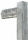
The Weardale Way
The Weardale Way in its entirety stretches from Cowshill in upper Weardale to the mouth of the River Wear and coast at Sunderland.

It winds its way for roughly 74 miles, passing through the contrasting landscapes and villages of rural Weardale, through historic Durham City, and eventually meandering through the more urban lowlands as the river meets the sea. Walkers can enjoy a wealth of historic and natural points of interest passing through moorland, pasture, arable, woodland, plantation, riverside, and towns and villages.
The Weardale Way (Cowshill to Sunderland Bridge)
The Weardale Way between Cowshill and Sunderland Bridge in County Durham (near Croxdale) is around 45 miles (72km) long. It has recently been freshly waymarked including wooden fingerposts where the route meets a road. Works have also been carried out to improve and renew many stiles and gates along the way. Funding for these improvements came from the Heritage Lottery Fund, via the Natural England: mineral valley project, which was managed by Natural England.
Below is a series of ten downloadable PDF maps of the route.
- This first map illustrates the locations of the ten sections of the route : Weardale Way - Map Key (PDF, 1 MB)
- Cowshill to Westgate - 4.5 miles : 7600m : Weardale Way - Map 1 (PDF, 513 KB)
- Westgate to Eastgate via Rookhope - 8 miles : 12800m: Weardale Way - Map 2 (PDF, 537 KB)
- Eastgate to Stanhope - 2.5 miles : 4200m : Weardale Way - Map 3 (PDF, 508 KB)
- Stanhope to White Kirkley - 4.5 miles : 7400m : Weardale Way - Map 4 (PDF, 512 KB)
- White Kirkley to Wolsingham - 5.5 miles : 9200m : Weardale Way - Map 5 (PDF, 481 KB)
- Wolsingham to Harperley - 3 miles : 4500m : Weardale Way - Map 6 (PDF, 483 KB)
- Harperley to Witton-le-Wear - 3 miles : 4600m : Weardale Way - Map 7 (PDF, 494 KB)
- Witton-le-Wear to Bishop Auckland - 5 miles : 8200m : Weardale Way - Map 8 (PDF, 529 KB)
- Bishop Auckland to Willington - 4 miles : 6500m : Weardale Way - Map 9 (PDF, 528 KB)
- Willington to Sunderland Bridge - 4.5 miles : 7300m : Weardale Way - Map 10 (PDF, 499 KB)
Why not take a bus ride up to your starting point? Weardale Travel operate the 101 bus service through Weardale. For more information on this bus service and other travel options take a look at the Plan your journey with Traveline North East page.
Any temporary closures along this route can be found on our Find out about roadworks in your area page.
More information
Cowshill to Killhope, an extension to the Weardale Way
This route is approximately four miles long. The attached leaflet is one in a series of leaflets promoting walks leading from the Weardale Way, produced as part of the Mineral Valleys Project. The leaflet can be viewed in PDF format: Cowshill to Killhope, an extension to the Weardale Way (PDF, 493 KB)
- Email prow@durham.gov.uk
- Telephone 03000 265 342

 Share this page on Facebook
 Share this page on Twitter
 Print this page


